How I want to be when I grow up…

This is a seriously AWESOME post by Dame Sandi Adams!!

Inspiring Aging or How I Want to Be When I Grow Up…

I’ve thought a lot about getting older lately… Probably because I am older. This birthday, I finally conceded to being middle aged…, considering 106 to be a respectable run. Sometimes I look in the mirror and am surprised. In my head, I don’t feel different and my body is still strong. ( though a few chinks in the armor are beginning..)
That is why I adore reading about people, who challenge themselves and are still moving, dancing, hiking, playing and living out dreams.

Last week I came across a blog post on Hiker to Hiker, that reallycarolina mt club made me smile. It was titled “Taking Care of the Elderly on the AT” The Carolina Mountain Club had planned a 9 mile hike led by an 81 year old. They all are over 50, as they point out, some way over 50. (These are my people)
Even thought it was hot, (we are southerners and it is hot here in the summer….) and the weather man kept telling them to “be careful and check on the elderly,” they still kept it moving and had a splendid day on the Appalachian Trail.

I’ve also been following Cimarron, an 88 year old man who has been THRU HIKINGthe Appalachian Trail since February and has completed 914.5 miles as of today.

cimarrontj11863_060811_183637_617926tj11863_061011_164724_618339
His quote before starting says it all, “If you never try to do it. You will never know you could do it.” You can read his trail journal HERE

This week Diana Nyed attempted to swim from Cuba to Key West, Florida at the age of 61. Moments before slipping into the water, Ms. Nyad, clad in a black swimsuit and a blue swim cap, played reveille on a bugle. “I’m almost 62 years old,” she declared. “I’m standing here at the prime of my life; I think this is the prime, when one reaches this age. You still have a body that’s strong, but now you have a better mind.”

While her journey was cut short, she still managed to swim for 29 hours, t1larg_diana_swimming_day1suffering through an asthma attack, shoulder pain, in cold. shark and jellyfish infested waters and finally abandoning her quest after becoming violently ill. Her comments following the experience were inspiring. She said that her goal had been to demonstrate to people in their 60s that “life is not over” and that the age of “60 is the new 40.” “I wasn’t the best swimmer I could be — the asthma and the shoulder made sure of that,” she said. “I was my most courageous self.”

“Life goes by so quickly and, at my age, you really feel the passage of time,” she said. “People my age must try to live vital, energetic lives. We’re still young. We’re not our mothers’ generation at 60.” For people over 60, she said, the goal should be “to live a life with no regrets and no worries about what you are going to do with your time. Fill it with passion. Be your best self.”
I think these are words that are worth living by no matter your age. So if you are sitting around on your hiney feeling sorry for yourself, put one foot in front of the other and you never know where you might end up.
We should all try to be our most courageous selves…

Backpacking Solo

Sunday, December 1, 2013

Backpacking solo

When Still Waters first asked me to help her with her first solo backpacking experience, I was eager to share what I’ve learned the last 3 years going solo. But there are also risks to backpacking by yourself. So we came up with a plan to do a two night trip- we’d backpack together the first night, and then the second night we’d each go solo on the same trail, and meet back up again afterwards. She’d have a chance to double check her gear on the first night (as the temps got down into the 20’s- burr!) before her first night out on her own.

Still Water, Solo Backpacker.
First night: comfortable into the 20’s
We set off on the Chattooga Cliffs Trail in North Carolina from the Bull Pen Bridge Trailhead (10.2 miles total out and back). This trail was really beautiful back in July, though I’d recalled it was also technically challenging- several rock scrambles and butt-scoots. As part of my preparations for the PCT, I was carrying a bear canister for the first time with enough food for several days. And if that wasn’t enough, the trail was icy so those were ice-encrusted rock scrambles, with the extra 10 lbs in my pack. This was NOT something I’d do solo, but it was a good challenge with Still Waters. One of the important things about choosing to go solo is deciding when to take risks and when to play it safe. When I go solo, I know where my limits are and where I can push things.

Icy and challenging Chattooga Cliffs Trail.

It was great practice carrying the bear canister, seeing how well it fit in my pack, and opening it in the cold with this method.
Selecting a solo campsite
We talked a lot the first night about differences between backpacking with a friend and going solo. For me the biggest difference is in choosing a campsite. When we camp with a group, campsite selection is often dictated by space or aesthetics, and is restricted (usually) to established sites. Going solo, I camp far from trailheads, and I make make myself either highly visible or highly invisible. If I use an established campsite, if anyone is camped nearby, I’ll be assertive and talk to the other campers and see if I get a good feeling, all before I set up. Otherwise, I stealth camp. On our first night, we camped at a stealth site that is typical for me when I go solo- we “went high”, halfway up the hillside where it is warmer, and hidden from view of the trail.

The Chattooga is gorgeous, but we didn’t camp near it cause it would have been even more cold down along it’s banks.
Why go solo?
Everyone has their own motivation for going solo. Still Waters was interested in having a quiet, peaceful experience. I went solo backpacking at first because I wanted the confidence boost and because I though it would prepare me for a thru hike, but then because I found it made me a more competent backpacker. It allowed me to do more miles than I would with friends or groups. As I experimented with pace, nutrition, and techniques, my backpacking skills improved by leaps and bounds as I learned to listen to my body and develop my own style that was in tune with what worked for me. Things I hadn’t learned when surrounded by other people when decisions are made for the benefit of the group. Guess the important thing is to keep in mind why you want to go solo.

Second night: going solo
The next morning, Still Waters dropped me off at the Bad Creek Trail, which led to the start of my Chattooga River Trail thru hike, while she set off on her solo from the Nicholson Ford Trailhead. I’ve section hiked the entire Chattooga River Trail multiple times, but this was my first time going in one continuous trip- 40.5 miles in 2 days. With the bear canister. With another 20-degree night. I’m not gonna lie- this trip reminded me about the best and worst of hiking solo. I hit a low point on the last day when I could tell I was pushing too fast. My feet were not used to carrying that much weight. I knew I needed take a break and not get so *freaking obsessed* with my miles per hour, and also not to worry so much about how many extra minutes it took me to get packed up in the morning fumbling around with my gloves on. When I’m solo, I see more clearly how I can be my own worst enemy.

At low points, it always helps to take dorky self-portraits, get email messages from friends, and write to-do lists.
But then, soloing has it’s high points too. One neat thing was seeing a bear as I hiked the last mile to my car in the dusk/dark. This was cool because not only wasn’t I scared of the bear like I used to be, but it was actually enjoyable seeing this wild creature- yay! I’ve seen enough bears now that I know what to expect from the bears around here. The other thing I like about going solo is that it makes me feel like I can take on anything I set my mind to. For example, I DIDN’T GET COLD HANDS despite the temps dipping into the 20’s. I also felt like I was in good shape, doing these back to back 20 mile days carrying extra weight with really short hours of daylight. So, happy overall.

After the trip, I met up with Still Waters to hear about her successful solo night on the trail. She’d found an awesome stealth site and stayed warm. Way to go Still Waters! Hope you have many safe and enjoyable nights out on the trail!

Here are some other tIps for going solo that we discussed:

-When first going solo, start small. I’d go to places where I was very comfortable- state parks where I could sign in at the park office, or the Appalachian Trail where there is a trail culture that I trust. Start with solo day hikes.

-Take care of yourself- this is your number one priority- don’t mess around. Listen to your body, adjust your pace, and be mindful.

-Be aware. Pay attention to everyone you see on the trail. Listen to your gut. Know your strengths and be prepared. I also took wilderness first aid and self-defense courses.

-Enjoy yourself. Do exactly what you want, when you want. Linger at waterfalls. Go swimming. Take a nap. Eat dinner at 3 PM. Savor every moment. Remember the distinction between being alone and being lonely.

Giving my feet a break and having an early dinner (dehydrated roasted veggies & sweet potato soup).
-Create a safety net. I tell two people where I’m going, where I’m parking, and when I’ll be back. I stick to the plan. I carry a cell phone and a SPOT. I check back in after I return, so my friends always expect my follow up text. My friends also have gotten in the habit of sending me foul weather alerts (thunderstorms, ice storms), and this has proved VERY helpful several times.

-Know where you can get cell signal. I don’t normally advocate relying on cell phones in the backcountry, but I have found it very helpful to know the locations of cell service on various ridges or gaps on some of my favorite trails. Where reception is faint, text messages are more reliable than calling or email.

-Don’t get lost. Until I was very comfortable going solo, I’d stick to routes I knew. I always pay constant attention to my location and where I am going. I take extra time at all trail junctions, I backtrack if I have any doubt, I take photos of signs and trail junctions (with time stamps so I keep track of my pace so I can calculate expected travel times to various places). I bring multiple maps and trail guides. I research my trips throughougly, calling the local ranger station a few days before, reading blogs, forums, and websites. I have backup plans and I know alternate routes.

-Bring music or podcasts to listen to before you go to sleep. Or bring earplugs. Helps keep away the sounds of night-time monsters. This doesn’t creep me out anymore (much) but it used to.

-Take advantage of the extra time and freedom to cultivate your backpacking skills. For example, spending extra time exploring when looking for campsites has provided me with a better understanding of how the wind moves over gaps and ridges and which plant communities are found on warmer vs. wetter slopes. I also spend more time taking photos and looking at plants when I’m by myself- all things I enjoy.

Still Waters

Trail Report-Pine Log Creek Trail

Trail report from Dame Sandi Adams…..

Pine Log Creek Trail….has it ALL!

Total distance: 4.6 miles
Parking lot Lead Trail: .46
West Loop : 2.12
East Loop: 1.54
Quarry Trail .03

After a friend at work told me about this trail, I put it on my short list for spontaneous hiking.(Also while searching for information about this trail, I read of a stray nude hiker that appears on it but this did not in any way influence my decision….) Friday morning started cool compared to the inferno heat we have been having so David and I packed it up and headed off to try it out.

Pine Log Creek Trail is located in Bartow County only 25 miles from our doorstep. We arrived early to an empty parking area, strapped on the pack and after viewing the faded out map posted, took off to the sounds of birds chattering and a neighboring rooster going crazy. Shortly after crossing a dry creek bed we came to a cool running bend in the creek with a beautifully built wooden bridge crossing. There are actually seven rustic footbridges over Pine Log Creek throughout the well maintained 5 mile hike. The trail includes two loops east and west and a short side trail to an old CCC quarry pond.
We opted to take the east loop first which took us over the creek and through a series of switchbacks to peaks of views of Pine Log Mountain. (Winter will be spectacular!) This trail overlooks a pastoral valley that was once home to the Cherokee village of Pine Log before the native people’s removal west on the Trail of Tears in the 1830s. There are numerous large rock croppings and boulders. The black eyed susans, several varieties of fern,( some HUGE), many giant very old trees along with the winding creek made this a very diverse beautiful trail. We saw traces of the stormy Spring in the form of someones chicken house roof scattered throughout the forest and brush.
The jewel of the trip was located a short distance off the trail in the form of an old quarry pond. David quickly identified several large mouth bass, brim and a stray catfish in the clear water vowing to bring a fishing pole the next trip. (NOTE: There is a large sign that prohibits fishing and overnight camping at the trail head) This was a peaceful, beautiful treat and great spot for a lunch or a quick swim.
After exploring the quarry we picked the trail back up and came to the west loop junction continuing over the creek and up the ridge for more views. We took a short stop to hang my hammock for David to tryout and discovered a little box turtle who watching our efforts. One thing to be aware of with this trail is someone has removed the trail loop signs. The posts are there but no signs. We found ourselves taking the east loop again before catching our mistake.
We ended our hike by cooling our feet and wading in the creek under the entry bridge. We both commented that it reminded us of childhood locations where we were free to play and explore. The only “excitement” of the trip came while we were drying off and observed a snake drop off the bank and swim right into the area we had been in. Of course I identified it as a copperhead or water moccasin but really think it was a red rat snake…
This trail is most definitely a jewel and will be on our list of backyard favorites.

http://www.youtube.com/watch?feature=player_embedded&v=4YE_ETyaTCM

Difficulty: Moderate-Some parts are listed as strenuous but not really
Directions
from I-575 in Canton: Take Riverstone Pkwy exit 20, head West for about .5 mi. Take right onto Reinhardt College Pkwy and continue until it dead ends into Hwy 140. Take right onto Hwy 140 W (still also Reinhardt College Pkwy) and go approximately 12 miles. Trail head will be on your right.
From I-75 in Cartersville: Take exit 293 and head North on Hwy 411 for about 7.5 mi. Take a right onto Hwy 140 East and go about 3.2 mi, trail head will be on your left.

Lansford Canal with the NC Dames

Lansford Canal with NC Trail Dames

Eight Trail Dames made it out Landsford Canal State Park in South Carolina!

Six of us met up to carpool (Beth, Kelly, Kimber, Nina, Deirdre, and me), while two
(Chris and Mara) met us at the park. We drove down to Landsford Canal State Park
to catch a glimpse of the infamous spider lilies that only seem to bloom this
time of year. It was a quick 30 minute drive and a $2 entrance fee each, but we
all agreed, it was worth the price of admission.

As we climb out of our cars, we exchange hellos and catch up with each other. I
notice
Chris’ new day hiking pack and her weight loss. I am so proud of her.
She looks great and her new pack makes her legit day hiker! haha! Seriously, her
pack was so cute. Kelly and I helped her fill it with water, showed her how it
worked, and explained where the hose goes.

We saw a lot of kayakers getting ready to enjoy the spider lilies up close and
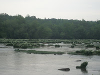
personal. You see, these little hardy flowers only grow on rocky shoals of a river and the Catawba River is one of the largest growing sites. The flowers
are literally growing on boulders in the middle of
the river!

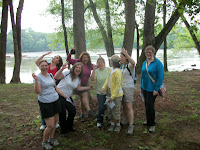
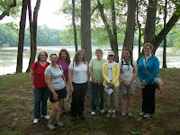
After gawking at the kayakers, we found a nice park ranger that was willing to take
our photos in exchange for our beautiful smiles. So we took our “beginning of
the hike” picture, then we took a silly Dame photo before finally hopping on the
trail. Chatting away, it amazes me how easily we all fall into conversations
with one another. We have an awesome group of ladies and I got a chance to talk
to each and every one of them.


The trail itself was a nice and easy, well maintained path that was very well
marked. We started along the river then turn right into the forest and walked
along the canal path. We learned that the early settlers made these man made
canals through the forest to keep themselves out of sight and safe. We stopped
to read all the historical signs and after a mile we reached the viewing
platform for the spider lilies.


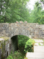
After taking lots of photos, and a water break, we continued on a nice easy trail for another 1/2 mile up to the stone bridge and official historical Indian
trade post sight. I snapped a couple of photos of the Dames on the bridge, then we hiked back to the lily platform one last time.

It started to sprinkle so I mentioned that maybe Kelly’s trail name should be Rainmaker. Cause
it seems that each time I’ve hiked with her, it seems to rain. haha! We finally get back to the cars and that’s when Nina surprises us. She pulls out a tupperware full of fresh strawberries to share! They tasted so yummy after our
hike. Thank you Nina! That was so thoughtful. We say goodbye to Chris and Mara
and then the rest of us hop back into my car and head back home. As soon as we
pull out of the state park, it starts to rain and we all look at Kelly and
laugh. haha! At least it didn’t rain on our hike! This was a great hike with a
great group. Looking forward to our next adventure Trail Dames.

Backpacking with Beiber

Backpacking with Beiber…..another wonderful post from Dame Sandi Adams


Backpacking was on Tanner’s summer bucket list, so we planned an overnight midweek trip. I chose the Cohutta Wilderness because it is my absolute favorite Georgia spot to backpack.
Meals were planned, maps consulted, the packs were loaded and off we went. The morning was sunny and warm as the Yaris took the rutted labyrinth of forest service roads like a champ and after what seemed like a hundred miles, we came to the Hickory Creek trailparking area. Not one soul to be seen… I checked the board for bear warning and nothing was posted which was a bit of a relief.
Perfect DayHickory Creek Trail HeadTanner and I adjusted our packs, locked the car and took off down the trail. The first part of the Hickory Creek Trail was rocky and weathered with evidence of the spring storms and all downhill as it wound its way to the creek. We hear the water before we can see it and soon get glimpses of the creek before our first crossing. Crystal clear, with plenty of water, it keeps us company as we continue down the trail. Soon we hit the intersection of theConasauga River Trail and Hickory Creek Trail where we turn right and begin looking for the perfect campsite.
Before long we come to the perfect balance of trees for my hammock and a niceIMG_2147 flat spot for the tent. The entire length of the site is situated directly on the Conasauga with a combination of deep pools ,little falls, huge boulders and the constant melody of the river. A covering of hemlocks, a nice big fire pit and a makeshift bench make it the unanimous choice. We go about the business of setting up camp, unpacking, gathering wood and having lunch.

IMG_2123After a short rest, we leave our site and head down the trail to explore.. We pass ginormous boulders, falls and swimming holes, a huge beaver dam which has turned into what must be a diverse mass of frogs, toads and Lord knows what else and come to the opening and intersection known as Bray field. (This used to be an old homestead but is now mainly used by backpackers.) We take off our shoes and wade across the Conasuaga River before I realize, we really don’t want to hike the entire Hickory Creek Trail, so we cross again and travel a bit down Tearbritches Trail, rockhopping the creek and wander along this beautiful easy section of the trail.
As the day turned into late afternoon, we head back to camp and take a swim in the cool clear river . We both enjoy some quiet time, then get to the business of preparing for the evening. We break up our wood, filter our water and settle down to cook dinner. Tanner is a great student of the outdoors, watching my every move and made my day when he tells me, “Mom, I can’t believe you know how to do all this stuff!!” After a satisfying, (although bland) meal of beef stroganoff and pudding, it starts to cool off and we get down to businessTanner and MomAwesome fire!and startthe fire. For years, I have watched my best friend, Leslie,THE FIREMASTER, start epic blazes. I have always been content to gather kindling and drag logs to the pile but she was not on this trip! Apparently, I was able to channel her talent and build one big honking fire!
We roasted a small bag of marshmallows, talked and stared into the fire (aka Hikers TV), until it got pretty late. The moon was new, so the night was DARK.
We made our way to our shelter, Tanner on the ground and me hanging in my hammocknearby and dozed off to the sound of the river. I woke around 7:00, rolled out of my warm bag and started another little fire. (Leslie, are you so proud?!) Sitting and drinking coffee and enjoying the beautiful cool morning, I counted my many blessings, one of which was laying in the tent next to me.
Tanner slept a little longer and finally crawled out, ate his bacon, cream cheese bagel and we reluctantly started to break camp.
IMG_2119Morning firePacked up to head homeDay Two

We climbed out of Hickory Creek around noon as the day warmed,IMG_2222taking our time while I told Tanner funny stories about David and our many adventures in the woods, pre-kids. An occasional stop for water, a view and to admire a little red salamander made for an enjoyable although, hot hike out.
On a funny note, as we reached the trailhead, I noticed that theBACK side of the information board was COVERED with bear warnings and information underneath the engraved message:WELCOME TO BEAR COUNTRY……LOL THIS was the BACK side of the trail head sign....
We loaded up our gear and took the rutted forest service road back toward 411 and after what seemed like fifty miles bouncing from bump to bump, popped out in the middle of nowhere . After consulting the map, we found our way to 411. A quick stop at a convenience store for icees and beef jerky and made our way back to Woodstock and civilization.
This trip will always have a special place in my heart and I will cherish it’s memory. My son,natural backpacker Tanner, is an incredible young man. He has been through adversity and difficult times but has emerged strong and confident with a natural, loving, unshakeable faith in God. I am proud of him and grateful for the time spent.