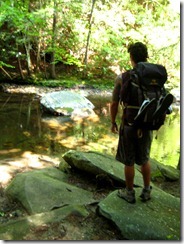
Maryland Dames Hike…..SNP

Awesome hike report from our Maryland Dames…..
Four of us set out on Wednesday, July 27th, for Shenandoah National Park to take on the 7 1/2 mile Rapidan-Laurel Prong -Hazel Top hike. We all went in my van and left Frederick at noon so that we could arrive at our lodge shortly after check-in time. We had reservations for two rooms, 2 queen beds in each room, at Big Meadows Lodge in the central district of SNP, mile marker 51. The drive went well and we had a wonderful time just chatting as we enjoyed the scenery along the way. We were at the lodge by 3:15 pm. We had hoped for, or actually assumed really, adjoined rooms but that was not to be. Barb K and I shared a room on the first floor of the Rapidan building and Barb M and Katrinka shared a room on the far end of the second floor. We did try to get the rooms changed but the lodge was already booked up and there was no way to manage it.

We settled our bags, checked out our rooms and the lovely views they had, and went to the lodge’s New Market Tap Room for drinks and appetizers. Not a bad way to start a hiking trip, aye? Winking smile We enjoyed cocktails, spinach dip and quesadillas while carrying on a nice long discussion about the books that we enjoyed and the possibility of a Dames book group in the future. Then it was upstairs to the lodge dining room for dinner and wine. Lovely! Afterward Barb K went to our room to relax and read while I went up to the other room to join Barb M and Katrinka on their balcony and watched the sun set. We watched deer silently stroll out of the woods to begin their evening browsing and we think we may have caught a glimpse of a black bear cub, still quite small, as it waddled out of the woods and into the safety of some heavy ground cover. It was a gorgeous evening of peace, towering pink edged clouds, and companionship. Off to bed as we had an early morning start planned.

Always an early riser, I was up first around 5 am, showered and sitting on the patio of our room drinking coffee as the sky lightened up. Birds called and sang, deer wandered out, and soft breezes rose along with the sun. We met for breakfast at 7:30 am, again eating in the lodge dining room, and then drove the 2 miles south to the trail head at Milam Gap parking lot. There was a short-lived panic attack on my part when I thought I had left my wallet in the lodge’s restroom. I raced back, searched around, found no one had turned it in, went back out to the van and searched again….to find it in the glove compartment. HUGE relief, but sorry that I had delayed our hike start.

We set off across the road and into the woods, hitting the Mill Prong Trail first. This part of the hike descends gently deeper and deeper into the woods toward Mill Prong Creek. The creek eventually joins Laurel Prong Creek and these two cold, rushing streams form Rapidan River, which drew President Herbert Hoover to the area with the dream of building a fishing camp as Presidential retreat – the first of it’s kind. Two miles in from the start of the hike, Rapidan Camp is the predecessor to Roosevelt’s Shangri-La in Thurmont MD, eventually renamed Camp David by President Eisenhower. We crossed the creek and picked up the trail again as it paralleled the water until we reached Rapidan Camp. The original Brown House (designed by Mrs Hoover as the residence) is still there and is often open for tours. There is usually a caretaker there to answer questions and explain the camp’s history. One other building, the Prime Minister’s cabin, is also open to the public and contains self-guided displays from the era. We spent about half an hour exploring the camp and chatting with the caretaker before picking up our poles and packs and setting off once more. The day was warming up but still much cooler than the heat we knew would be building in the Frederick area by then.

We hiked along about another mile or so on easy terrain, crossing creeks, and eventually reaching the beginning of a 3 mile ascent that would take us up to Hazel Top, the 3rd highest point in SNP. The first mile of the ascent is a long, steep, switchback. It tops out on a ridge line, takes a hard right turn, and continues up and up and up the side of the ridge. Enormous, ancient rock formations form a wall on your right and the steep descending hillside and valleys are on your left. The trail grows quite rocky and narrow as it takes you the 2 miles to it’s junction with the AT. We identified wildflowers along the way – native red columbine, turk’s cap lily, joe-pye weed, trumpet vine. There were many others that we could not identify in spite of the book I was carrying – “Wildflowers of Shenandoah National Park.” For a few seconds we found ourselves frozen in place as the unmistakable whine-roar of low flying fighter jets approached. We caught a glimpse of them through the tree cover and they were gone in a flash.

I had done this hike with my husband in May 2010 and I truly did not recall the long steep slog from the junction of the AT to Hazel Top! From the start of the ascent on the switchback to Hazel Top we gained 1000 feet of elevation. That’s a lot of continuous gain. The day was definitely getting hotter and more humid. We found some rocks to sit on (before reaching Hazel Top) and sat down to rest and eat our lunches. Huge flies clung and bit, no doubt feasting on our salty sweaty selves. We swatted, ate, cursed, ate, swatted, cursed…….pretty much any typical lunch stop on any summer time hike in the northeast! We finished up, stood up on sore, tight leg muscles, and continued on to our goal of Hazel Top summit.

There is a short side trail leading to the left off of the AT to the rock formations that give the best panoramic views of the mountains and valleys. As each person climbed up onto the rocks “Oh my, look at that.” “Oh my God” “Wow, just wow.” could be heard. Ridge after ridge after ridge of mountains dipped, rose, and dipped and rose again in the distance in multi-colors of greens, blues, grays. We took it all in, deeply grateful for the opportunity to be out there. With deep sighs, it was time to move on. From this point the AT is described as taking an “incredibly delightful descent”, and delightful it is. The trail heads down and down in a very gentle slope, through trees, grasses, huge stands of turk’s cap lilies, ferns that were 3 – 4 feet tall. We encountered a pair of deer on the trail and stood still and silent. They did the same and gazed back at us. As we slowly moved forward they would also move away from us, but never very far nor very fast. They stepped into the woods and grass and let us get within about 30 feet. We took pictures, thanked them for their cooperation and patience with us, and continued on back to Milam Gap and the van.

We made a stop at Big Meadows Wayside to use the restrooms, buy some cold drinks and blackberry ice cream, piled back into the van and took off for home. It was agreed all around that our time in SNP was perfection and that we definitely want to do it again. It is well worth the time and expense to get there the day before a long hike and spend the night. We also realized that it would have been very well worth the cost to stay one more night after the hike, rather than make a 3 – 4 hour drive back. The lodges feature live music in the evenings and it would have been heaven to go back to our rooms, shower, change into non-hiking clothes, and enjoy another night of cocktails, dinner, and some good ol’ mountain music.

The photos of this hike can be found on the Meetup site. Enjoy!

Linda

How I want to be when I grow up…

This is a seriously AWESOME post by Dame Sandi Adams!!

Inspiring Aging or How I Want to Be When I Grow Up…

I’ve thought a lot about getting older lately… Probably because I am older. This birthday, I finally conceded to being middle aged…, considering 106 to be a respectable run. Sometimes I look in the mirror and am surprised. In my head, I don’t feel different and my body is still strong. ( though a few chinks in the armor are beginning..)
That is why I adore reading about people, who challenge themselves and are still moving, dancing, hiking, playing and living out dreams.

Last week I came across a blog post on Hiker to Hiker, that reallycarolina mt club made me smile. It was titled “Taking Care of the Elderly on the AT” The Carolina Mountain Club had planned a 9 mile hike led by an 81 year old. They all are over 50, as they point out, some way over 50. (These are my people)
Even thought it was hot, (we are southerners and it is hot here in the summer….) and the weather man kept telling them to “be careful and check on the elderly,” they still kept it moving and had a splendid day on the Appalachian Trail.

I’ve also been following Cimarron, an 88 year old man who has been THRU HIKINGthe Appalachian Trail since February and has completed 914.5 miles as of today.

cimarrontj11863_060811_183637_617926tj11863_061011_164724_618339
His quote before starting says it all, “If you never try to do it. You will never know you could do it.” You can read his trail journal HERE

This week Diana Nyed attempted to swim from Cuba to Key West, Florida at the age of 61. Moments before slipping into the water, Ms. Nyad, clad in a black swimsuit and a blue swim cap, played reveille on a bugle. “I’m almost 62 years old,” she declared. “I’m standing here at the prime of my life; I think this is the prime, when one reaches this age. You still have a body that’s strong, but now you have a better mind.”

While her journey was cut short, she still managed to swim for 29 hours, t1larg_diana_swimming_day1suffering through an asthma attack, shoulder pain, in cold. shark and jellyfish infested waters and finally abandoning her quest after becoming violently ill. Her comments following the experience were inspiring. She said that her goal had been to demonstrate to people in their 60s that “life is not over” and that the age of “60 is the new 40.” “I wasn’t the best swimmer I could be — the asthma and the shoulder made sure of that,” she said. “I was my most courageous self.”

Life goes by so quickly and, at my age, you really feel the passage of time,” she said. “People my age must try to live vital, energetic lives. We’re still young. We’re not our mothers’ generation at 60.” For people over 60, she said, the goal should be “to live a life with no regrets and no worries about what you are going to do with your time. Fill it with passion. Be your best self.”
I think these are words that are worth living by no matter your age. So if you are sitting around on your hiney feeling sorry for yourself, put one foot in front of the other and you never know where you might end up.
We should all try to be our most courageous selves…

Trail Report-Pine Log Creek Trail

Trail report from Dame Sandi Adams…..

Pine Log Creek Trail….has it ALL!

Total distance: 4.6 miles
Parking lot Lead Trail: .46
West Loop : 2.12
East Loop: 1.54
Quarry Trail .03

After a friend at work told me about this trail, I put it on my short list for spontaneous hiking.(Also while searching for information about this trail, I read of a stray nude hiker that appears on it but this did not in any way influence my decision….) Friday morning started cool compared to the inferno heat we have been having so David and I packed it up and headed off to try it out.

Pine Log Creek Trail is located in Bartow County only 25 miles from our doorstep. We arrived early to an empty parking area, strapped on the pack and after viewing the faded out map posted, took off to the sounds of birds chattering and a neighboring rooster going crazy. Shortly after crossing a dry creek bed we came to a cool running bend in the creek with a beautifully built wooden bridge crossing. There are actually seven rustic footbridges over Pine Log Creek throughout the well maintained 5 mile hike. The trail includes two loops east and west and a short side trail to an old CCC quarry pond.
We opted to take the east loop first which took us over the creek and through a series of switchbacks to peaks of views of Pine Log Mountain. (Winter will be spectacular!) This trail overlooks a pastoral valley that was once home to the Cherokee village of Pine Log before the native people’s removal west on the Trail of Tears in the 1830s. There are numerous large rock croppings and boulders. The black eyed susans, several varieties of fern,( some HUGE), many giant very old trees along with the winding creek made this a very diverse beautiful trail. We saw traces of the stormy Spring in the form of someones chicken house roof scattered throughout the forest and brush.
The jewel of the trip was located a short distance off the trail in the form of an old quarry pond. David quickly identified several large mouth bass, brim and a stray catfish in the clear water vowing to bring a fishing pole the next trip. (NOTE: There is a large sign that prohibits fishing and overnight camping at the trail head) This was a peaceful, beautiful treat and great spot for a lunch or a quick swim.
After exploring the quarry we picked the trail back up and came to the west loop junction continuing over the creek and up the ridge for more views. We took a short stop to hang my hammock for David to tryout and discovered a little box turtle who watching our efforts. One thing to be aware of with this trail is someone has removed the trail loop signs. The posts are there but no signs. We found ourselves taking the east loop again before catching our mistake.
We ended our hike by cooling our feet and wading in the creek under the entry bridge. We both commented that it reminded us of childhood locations where we were free to play and explore. The only “excitement” of the trip came while we were drying off and observed a snake drop off the bank and swim right into the area we had been in. Of course I identified it as a copperhead or water moccasin but really think it was a red rat snake…
This trail is most definitely a jewel and will be on our list of backyard favorites.

http://www.youtube.com/watch?feature=player_embedded&v=4YE_ETyaTCM

Difficulty: Moderate-Some parts are listed as strenuous but not really
Directions
from I-575 in Canton: Take Riverstone Pkwy exit 20, head West for about .5 mi. Take right onto Reinhardt College Pkwy and continue until it dead ends into Hwy 140. Take right onto Hwy 140 W (still also Reinhardt College Pkwy) and go approximately 12 miles. Trail head will be on your right.
From I-75 in Cartersville: Take exit 293 and head North on Hwy 411 for about 7.5 mi. Take a right onto Hwy 140 East and go about 3.2 mi, trail head will be on your left.

Backpacking with Beiber

Backpacking with Beiber…..another wonderful post from Dame Sandi Adams


Backpacking was on Tanner’s summer bucket list, so we planned an overnight midweek trip. I chose the Cohutta Wilderness because it is my absolute favorite Georgia spot to backpack.
Meals were planned, maps consulted, the packs were loaded and off we went. The morning was sunny and warm as the Yaris took the rutted labyrinth of forest service roads like a champ and after what seemed like a hundred miles, we came to the Hickory Creek trailparking area. Not one soul to be seen… I checked the board for bear warning and nothing was posted which was a bit of a relief.
Perfect DayHickory Creek Trail HeadTanner and I adjusted our packs, locked the car and took off down the trail. The first part of the Hickory Creek Trail was rocky and weathered with evidence of the spring storms and all downhill as it wound its way to the creek. We hear the water before we can see it and soon get glimpses of the creek before our first crossing. Crystal clear, with plenty of water, it keeps us company as we continue down the trail. Soon we hit the intersection of theConasauga River Trail and Hickory Creek Trail where we turn right and begin looking for the perfect campsite.
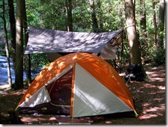
Before long we come to the perfect balance of trees for my hammock and a niceIMG_2147 flat spot for the tent. The entire length of the site is situated directly on the Conasauga with a combination of deep pools ,little falls, huge boulders and the constant melody of the river. A covering of hemlocks, a nice big fire pit and a makeshift bench make it the unanimous choice. We go about the business of setting up camp, unpacking, gathering wood and having lunch.

IMG_2123After a short rest, we leave our site and head down the trail to explore.. We pass ginormous boulders, falls and swimming holes, a huge beaver dam which has turned into what must be a diverse mass of frogs, toads and Lord knows what else and come to the opening and intersection known as Bray field. (This used to be an old homestead but is now mainly used by backpackers.) We take off our shoes and wade across the Conasuaga River before I realize, we really don’t want to hike the entire Hickory Creek Trail, so we cross again and travel a bit down Tearbritches Trail, rockhopping the creek and wander along this beautiful easy section of the trail.
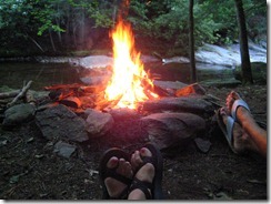
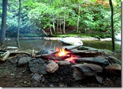
As the day turned into late afternoon, we head back to camp and take a swim in the cool clear river . We both enjoy some quiet time, then get to the business of preparing for the evening. We break up our wood, filter our water and settle down to cook dinner. Tanner is a great student of the outdoors, watching my every move and made my day when he tells me, “Mom, I can’t believe you know how to do all this stuff!!” After a satisfying, (although bland) meal of beef stroganoff and pudding, it starts to cool off and we get down to businessTanner and MomAwesome fire!and startthe fire. For years, I have watched my best friend, Leslie,THE FIREMASTER, start epic blazes. I have always been content to gather kindling and drag logs to the pile but she was not on this trip! Apparently, I was able to channel her talent and build one big honking fire!
We roasted a small bag of marshmallows, talked and stared into the fire (aka Hikers TV), until it got pretty late. The moon was new, so the night was DARK.
We made our way to our shelter, Tanner on the ground and me hanging in my hammocknearby and dozed off to the sound of the river. I woke around 7:00, rolled out of my warm bag and started another little fire. (Leslie, are you so proud?!) Sitting and drinking coffee and enjoying the beautiful cool morning, I counted my many blessings, one of which was laying in the tent next to me.
Tanner slept a little longer and finally crawled out, ate his bacon, cream cheese bagel and we reluctantly started to break camp.
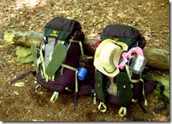
IMG_2119Morning firePacked up to head homeDay Two

We climbed out of Hickory Creek around noon as the day warmed,IMG_2222taking our time while I told Tanner funny stories about David and our many adventures in the woods, pre-kids. An occasional stop for water, a view and to admire a little red salamander made for an enjoyable although, hot hike out.
On a funny note, as we reached the trailhead, I noticed that theBACK side of the information board was COVERED with bear warnings and information underneath the engraved message:WELCOME TO BEAR COUNTRY……LOL THIS was the BACK side of the trail head sign....
We loaded up our gear and took the rutted forest service road back toward 411 and after what seemed like fifty miles bouncing from bump to bump, popped out in the middle of nowhere . After consulting the map, we found our way to 411. A quick stop at a convenience store for icees and beef jerky and made our way back to Woodstock and civilization.
This trip will always have a special place in my heart and I will cherish it’s memory. My son,natural backpacker Tanner, is an incredible young man. He has been through adversity and difficult times but has emerged strong and confident with a natural, loving, unshakeable faith in God. I am proud of him and grateful for the time spent.

Reedy Creek- Guest Post from the North Carolina Dames

Reedy Creek Hike

9 Dames made it out on a beautiful mothers day morning for the 3 mile Reedy Creek hike.  (Nina, Lori, Kimber, Chelsea, Diane, Diana, Dolores, Kathy, and me.)  We all met up at the nature center where we chatted a bit before trail maps were passed around.  After taking the “before” picture, we headed down past the Nature Center and started our hike on the yellow Umbrella Tree trail.  We hiked in around .33 miles before Diana decided to take the short cut trail to meet us at the Robinson Rock house.  We all continued the next mile on the blue Big Oak trail.  Everyone seemed to be chatting away and hiking around the same pace, which was great, because I was able to talk to each Dame 🙂

We finally reach the intersection of yellow Umbrella Tree trail.  We stop and I ask Nina which way we should go.  She checks out her map decides we need to turn right.  Perfect!  She and Dolores keep the lead and pace going for the hike for another .33 miles before we come to the next intersection.  Again the ladies consult the map and keep us going in the right direction.  We take a right, then stop to admire a big tree that Dolores points out  before we continue another .33 miles on the red South Fork trail.  We finally run into the orange Robinson Rockhouse trail, hang a right and continue another .33 miles down to the rock ruins.  Dolores was the first to notice the sweet aroma that a honeysuckle makes and I made sure everyone else caught a whiff of that sweet scent lingering in the air.  A few feet later, we passed by the honeysuckle plant and I was so tempted to pluck a flower and taste the nectar.  But alas… we were in a county park where we are not allowed to pluck, pull, cut, or pick up any flower, fauna, tree, or shrub.  So.. I took a deep breathe and settled for the sweet aroma in the air 🙂

I love this section of the trail, not only
because it’s beautiful, but because when you near the end, you round a bend in the trail and then all of the sudden, you stumble upon the rock ruins.  We stopped here for 15 minutes, enjoying and exploring the ruins.  Kathy shared her yummy trail mix with me and I told her I would be hiking with her from now on! haha!  We take our Trail Dames group photo and hop back on the trail.  This time, Kimber and Chelsea lead the way with Chelsea using her map skills to get us back to our car. At the trail intersection we run into Diana, seems as if her short cut, ended up being a long cut!  After adding up her mileage, she had hiked around the same miles as we did. haha!  Oh well, at least we all hiked back out together.  When we get to the nature center, everyone walks over to the pond and picnic table, while Lori and I head back down the trail to check on Diana.  She was right on our heels.  When we get to the picnic table, we all say our goodbyes and head back to our cars.